
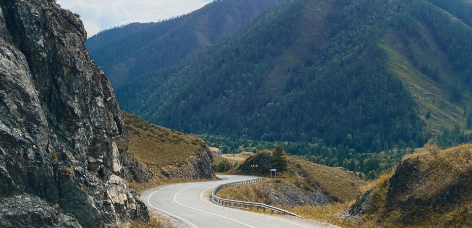
The Ha Giang Loop has gone from a route almost nobody had heard of to the single most popular thing to do in northern Vietnam, and it happened in under a decade. It is a circuit of roughly 350 kilometres through limestone mountains along the Chinese border, and most people take three or four days over it. What follows is an honest look at what the route is like now, how travelers ride it, and when it is worth going.
Where the loop actually runs
The circuit starts and ends in Ha Giang city, about six hours north of Hanoi by road. Ha Giang is now part of Tuyen Quang province following the 2025 administrative reform, though nobody calls the route anything other than the Ha Giang Loop.
Most of the ride crosses the Dong Van Karst Plateau, a landscape of grey limestone towers and narrow farmed valleys that UNESCO recognises as a Global Geopark. Around a quarter of a million people live up there, the majority from ethnic minority groups including Hmong, Tay, Dao and Lo Lo communities. Maize grows in pockets of soil packed between rocks, on slopes that look too steep to stand on.
The section everyone comes for is Ma Pi Leng Pass, where the road is cut into a cliff several hundred metres above the Nho Que river. It earns the reputation. The rest of the route is quieter and less dramatic, but the villages and the weekly markets are the part most people talk about afterwards.
Three ways to do it, and which one suits you
Riding yourself is the cheapest option and gives you complete control over the schedule. It is also the one that puts people in hospital. The roads are steep, frequently wet, and shared with trucks, buffalo and children. A licence that covers you legally in Vietnam matters here, because most travel insurance will refuse a claim without one. Anyone who has not ridden a manual bike on mountain roads before should think hard about this.
Hiring a local driver, usually called an easy rider, means sitting on the back and looking at the view instead of the road surface. This is what most visitors now do, and for anyone without real riding experience it is the sensible choice.
Going by car is the least atmospheric option, but it works for families, older travelers, or anyone visiting in cold weather. The main roads are sealed and in reasonable condition.
What the loop is actually like now
It is busy. In peak season, groups of twenty or more bikes travel the main road together, and the viewpoints at Ma Pi Leng and Lung Cu get crowded through the middle of the day. Anyone imagining an empty mountain road with nobody else on it will be disappointed.
The crowds also thin out faster than you would expect. Ride ten minutes down a side road toward the border and the traffic disappears. The smaller weekly markets see very few foreign visitors. Early mornings are quiet everywhere, and most groups do not leave their guesthouse before eight.
The other change worth knowing about is where the money ends up. The loop generates significant income now, but a lot of it is captured by operators based in Hanoi or Ha Giang city rather than the villages the route passes through. Staying in locally owned places and eating along the way, rather than only at organised group stops, makes a real difference to households on the plateau.
When to go
September and October are the best months. The rice terraces turn gold before harvest, the air is clear, and daytime temperatures are comfortable for riding.
March to May is the second window. It is dry, the mountains are green, and in some valleys the plum and pear blossom is out.
Winter, from December to February, is genuinely cold. Temperatures on the plateau drop close to freezing at night and thick fog can sit on the passes for days, hiding the views completely. It is atmospheric if the weather goes your way and a waste of four days if it does not.
June to August is the wet season. The landscape is at its greenest, but heavy rain causes landslides and leaves the road surfaces slippery. Riding through it is not much fun.
Fitting it into a Vietnam trip
The loop needs more time than people plan for. Counting travel from Hanoi, three days of riding plus a night at each end, five days is the realistic minimum and a week is more comfortable. Distances between overnight stops are short but slow, and a day by day breakdown of the route is worth reading before you commit to a schedule.
It also works better early in a trip than late. The northern mountains are a completely different experience from Hoi An or the Mekong Delta, and doing them first gives the rest of the country something to contrast against.
The Ha Giang Loop is no longer undiscovered, and pretending otherwise helps nobody. What it still offers is a working mountain landscape where people farm slopes at impossible angles, a road that genuinely deserves its reputation, and villages where foreign visitors remain unusual enough to be interesting. That is worth four days of anyone’s trip.
 By
By 


