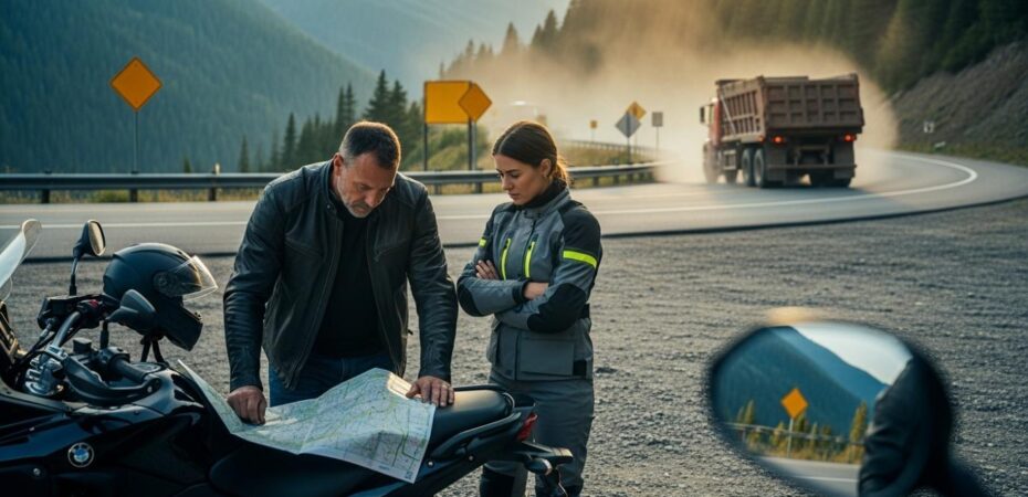
Virginia offers incredible ridge views, historic colonial towns, and sprawling coastal stretches that reward any rider chasing an unforgettable road trip. But the same geographical variety that makes this state so stunning also makes its highways deeply unpredictable for motorcyclists. Your route planning should double as a safety strategy, not just an adventure outline. In this guide, you’ll learn how to navigate changing road conditions and protect yourself along the way.
Riders frequently underestimate how quickly the environment shifts as they move between Virginia’s distinct regions. You might start your morning cruising a quiet two-lane country highway and find yourself battling interstate gridlock before lunch. Sound familiar? Planning a successful trip means recognizing these hazardous patterns before you actually encounter them on two wheels.
Getting a handle on the unique hazards of riding in Virginia lets you plan your routes, timing, and road positioning more strategically. It’s all about giving you the tools to stay safe and steady out there, without taking away any of the actual joy of hitting the open road.
Route Risks Virginia Riders Should Know
Why Virginia Riding Conditions Change So Quickly
Mountain roads feature blind curves that suddenly drop into dense suburban corridors, offering little warning to riders. Think of it like the difference between trail hiking and jaywalking across a busy parking lot; the transition happens that fast. Interstate stretches like I-81 and I-64 require high-speed merges next to heavy commercial traffic moving across the state. Coastal approaches often bring sudden congestion and tunnel bottlenecks that catch out-of-town riders off guard.
Weather swings add another layer of difficulty, as heavy fog can roll into the valleys almost instantly, especially in the Blue Ridge during spring and fall. Preparing for these rapid environmental shifts helps you maintain focus and control throughout your entire journey.
What Recent Virginia Crash News Tells Riders
Statewide collision reports show exactly how unpredictable these riding environments remain for both local and touring motorcyclists. A crash on I-64 in Chesapeake involved a high-speed rear-end collision, shutting down lanes and severely injuring the rider. A crash on Richmond Highway in Lorton left a motorcyclist with life-threatening injuries during the hectic morning rush hour. Meanwhile, a fatal crash in Fairfax County involving a tractor-trailer on Route 29 proves the severe risk of riding near heavy freight. Single-vehicle incidents also pose major threats; a crash on Route 288 in Chesterfield and a fatal crash on Route 250 in Waynesboro, where a rider lost control and crossed the center line, show how quickly things can go wrong even without another vehicle involved.
The Most Dangerous Route Patterns for Motorcyclists in Virginia
Busy Intersections and Left-Turn Conflict Zones
Multi-lane arterials and shopping corridor entrances create high-risk conflict points where cars frequently cross paths with motorcycles. Highway ramps feeding into signalized intersections leave drivers scanning for large gaps rather than watching for smaller vehicles. When oncoming drivers misjudge your speed, the resulting collisions can be devastating for the unprotected rider.
Suburban environments are packed with these dense access points (picture any stretch of Route 1 near a Walmart or strip mall), forcing you to constantly monitor vehicles waiting in the turn lanes. Staying visible and preparing emergency braking strategies can genuinely save your life when navigating these crowded commercial districts.
Commercial Construction and Truck-Heavy Corridors
The I-81 freight corridor and Northern Virginia development zones put riders in close proximity to massive commercial vehicles daily. Active construction areas introduce temporary lane shifts, loose gravel, and abruptly narrowed shoulders that can reduce motorcycle stability in seconds. The recent fatality in Braddock involving a tractor-trailer underscores the danger of sharing local corridors with large commercial trucks.
Heavy trucks also create significant wind buffeting, which can push a lighter motorcycle out of its lane before you have time to correct. Ask any rider who’s done I-81 from Staunton to Roanoke on a weekday, and they’ll tell you the same thing: give these massive vehicles plenty of space and pass them swiftly to reduce your exposure to sudden blowouts or debris.
Scenic Roads That Reward Skill and Punish Mistakes
Blue Ridge Parkway access roads and Skyline Drive feeders tempt riders with beautiful elevation changes and sweeping turns. However, these rural two-lane highways mix distracted tourist traffic with wildlife, leaf debris, and extremely limited escape space. The Waynesboro Route 250 crash shows how quickly a small mistake on a mountain curve can become a major crossover collision.
Tight corners hide stalled vehicles or slow-moving farm equipment just out of your immediate line of sight. Riding within your personal skill limits ensures you have enough reaction time when the scenery suddenly gives way to a hidden hazard. Not where you expected a travel guide to go, right? But this is the reality of Virginia riding.
Certain highway characteristics should immediately put you on high alert as you ride through unfamiliar Virginia territory. Recognizing these hazard patterns lets you adjust your speed and lane positioning before an emergency develops. Watch carefully for these specific visual cues that indicate a heightened risk of collisions or loss of control:
- Repeated left-turn access points into gas stations, shopping centers, or private driveways
- Narrow shoulders with steep drop-offs and limited escape space
- Active construction signage, temporary pavement changes, or visible work trucks
- Frequent, short merge lanes near busy highway interchanges
- Blind curves immediately followed by signalized intersections (common on routes like 29 and 250)
- Heavy tourist traffic mixed with aggressive local commuter driving
- Long downhill mountain sections leading directly into stoplights
- Rough pavement, thick tar snakes, or loose gravel at curve entries
The Intersection Problem: Why Riders Need to Read the Road Ahead
The Data Behind Left-Turn Motorcycle Crashes
Intersections remain the deadliest zones for riders navigating Virginia towns and suburban thoroughfares. In 2023, left-turning vehicles were responsible for 46% of all fatal two-vehicle motorcycle accidents across the country, typically striking riders who were simply proceeding straight through an intersection or overtaking traffic. A 2017 to 2021 medical study revealed that left-turn-across-path crashes accounted for 26% of fatal two-vehicle incidents involving motorcycles.
On top of that, the U.S. Department of Transportation reports that 53% of crossing-path crashes involve left turns, compared with only 6% for right turns. That gap is staggering. Drivers often fail to register the narrow profile of an approaching motorcycle against a busy background, which is why so many of these crashes happen in broad daylight at seemingly ordinary intersections.
What These Intersections Actually Look Like
Suburban six-lane roads and signalized crossroads near retail clusters create chaotic visual environments that overwhelm drivers. Town-edge intersections where speed zones suddenly drop are routinely caught off guard by speeding commuters and distracted locals. The Lorton crash on Richmond Highway at Mims Street highlights the danger of navigating busy commuter intersections during morning rush hour. A crash in Purcellville at Hirst Road shows how ordinary local crossroads quickly turn into major injury scenes.
You’ve probably ridden through dozens of these intersections without thinking twice. But the safest mindset is to assume every vehicle waiting ahead of you will pull out in front of you until you safely pass it. Paranoid? Maybe. But it works.
|
Route Type |
Common Hazard Pattern |
Why It Matters for Riders |
|
Urban arterial intersections |
Left-turning drivers, multiple signals, driveway entries |
Little time to react and many conflict points |
|
Interstate freight corridors |
Fast traffic, lane changes, trucks, debris |
Reduced visibility and severe crash forces |
|
Scenic mountain roads |
Curves, elevation changes, limited shoulders |
Small mistakes can become major crashes |
|
Rural two-lane highways |
Wildlife, variable pavement, hidden driveways |
Hazards appear with less warning |
|
Construction corridors |
Uneven pavement, lane shifts, trucks |
Bike stability and escape options shrink |
Smart Trip Planning Tweaks That Reduce Risk Before You Roll
Plan Around Traffic Timing, Not Just Distance
Avoid scheduling your rides through Northern Virginia, Richmond, or Hampton Roads during their heaviest commuter windows. If you’ve ever been stuck on I-95 south of Woodbridge at 5:30 PM, you already know why. Build your fuel and rest stops well before you enter dense metro areas to maintain strong situational awareness.
Giving yourself plenty of daylight for mountain sections helps you spot sudden hazards like deer or damp leaves. Fatigue reduces your reaction time, making a safe morning road far more dangerous by late afternoon. Scheduling enough downtime helps you stay sharp when traffic thickens around major cities.
How to Use Mapping Tools More Strategically
Smart travel requires looking beyond the simple line on your GPS screen to anticipate the actual road conditions you’ll be riding through. Review alternate routes, check your stop spacing, and identify urban choke points before you leave the driveway. A map guide by TravelTweaks can show you how to layer your itinerary to avoid high-risk congestion zones.
Digital tools let you spot heavy commercial districts and bypass them in favor of quieter secondary roads, which is great news if you prefer riding over sitting in traffic. Better mapping directly translates to lower stress, keeping your mind focused on operating your motorcycle smoothly rather than scrambling for a last-minute detour.
Build a Buffer for Virginia-Specific Riding Variables
Virginia weather swings widely in the mountains, bringing sudden fog at elevation or intense summer storm runoff across the pavement. Expect heavy tourist congestion along scenic corridors during peak leaf-peeping and summer vacation seasons, when drivers may focus more on the views than on the road ahead.
Work-zone slowdowns around commercial growth areas require extra patience and a stable, unhurried pace to navigate safely. Treating route planning as a way to reduce stress points before they become road hazards, rather than just mapping point A to point B, makes a real difference. Planning a flexible itinerary guarantees you never feel rushed to push through dangerous weather or heavy traffic.
Legal Preparedness Matters More in Virginia Than Many Riders Realize
Understanding Virginia’s Contributory Negligence Standard
Virginia uses a strict contributory negligence rule for personal injury claims, creating a uniquely difficult legal landscape for motorists. So what does that actually mean for you? This standard means that even small allegations of rider fault can completely block your ability to recover financial damages. Insurance adjusters frequently try to place some of the blame on the motorcyclist to avoid paying legitimate claims.
Documenting the scene thoroughly and monitoring your post-crash behavior become critical steps for any traveler involved in an accident. Understanding this strict standard highlights why proactive safety measures and defensive riding matter so much in Virginia, especially compared to most other states you’ll ride through.
If a Trip Is Interrupted by an Intersection Crash
When an oncoming vehicle violates your right-of-way, physical evidence often tells the true story of the collision. Roadway markings, debris fields, vehicle positions, witness names, and signal timing all matter for building a factual timeline. If your trip is interrupted by an intersection collision, understanding how proving a left-turn driver was at fault can help clarify how roadway evidence, witness statements, and Virginia traffic law establish responsibility.
Collecting this data immediately helps prevent the at-fault driver from later changing their story about speed or turn signals. Gathering proper documentation on the spot can protect your legal standing in a state that closely scrutinizes rider actions (and yes, there’s a catch: Virginia’s contributory negligence rule means even minor oversights in your documentation can work against you).
What to Prioritize After a Crash While Traveling
Your immediate priority must always be securing emergency medical care and requesting a formal police report from responding officers. Take clear photos of the vehicles, the intersection layout, and your damaged gear, if you’re physically able to do so. Gather witness contact information immediately, as helpful bystanders often leave before investigators arrive.
Never speculate about fault, guess your speed, or apologize to the other driver while waiting for authorities. Follow up promptly with medical professionals, even if your injuries seem minor, to establish a clear medical record. This applies doubly when you’re traveling far from home and might not have your usual doctor to follow up with later.
A Safer Virginia Ride Starts With Better Route Choices
Virginia remains a fantastic riding destination filled with unforgettable landscapes, historic landmarks, and welcoming rural communities. The biggest risks are often predictable if you know what to watch for at busy intersections and active freight corridors.
Safer travel comes from choosing smarter roads, picking better timing, and maintaining strong legal awareness throughout your journey. With the right preparation and mindset, Virginia’s highways can still deliver the open-road ride you came for. The best memories should come from the scenery, not the close calls.
 By Olivia Gril


